


FREMONT - T 1 Voting District, Waupaca County, Wisconsin
About
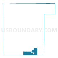
Outline

Summary
| Unique Area Identifier | 698129 |
| Name | FREMONT - T 1 Voting District |
| County | Waupaca County |
| State | Wisconsin |
| Area (square miles) | 20.08 |
| Land Area (square miles) | 18.99 |
| Water Area (square miles) | 1.09 |
| % of Land Area | 94.57 |
| % of Water Area | 5.43 |
| Latitude of the Internal Point | 44.26125510 |
| Longtitude of the Internal Point | -88.94757210 |
Maps


Graphs
Select a template below for downloading or customizing gragh for FREMONT - T 1 Voting District, Waupaca County, Wisconsin


Neighbors
Neighoring Voting District (by Name) Neighboring Voting District on the Map
- BLOOMFIELD - T 1 Voting District, Waushara County, WI
- BLOOMFIELD - T 2 Voting District, Waushara County, WI
- CALEDONIA - T 1 Voting District, Waupaca County, WI
- CALEDONIA - T 2 Voting District, Waupaca County, WI
- Fremont - V 1 Voting District, Waupaca County, WI
- LIND - T 1 Voting District, Waupaca County, WI
- WEYAUWEGA - T 1 Voting District, Waupaca County, WI
- WOLF RIVER - T 1 Voting District, Winnebago County, WI
- WOLF RIVER - T 2 Voting District, Winnebago County, WI
Top 10 Neighboring County Subdivision (by Population) Neighboring County Subdivision on the Map
- Caledonia town, Waupaca County, WI (1,627)
- Lind town, Waupaca County, WI (1,579)
- Wolf River town, Winnebago County, WI (1,189)
- Bloomfield town, Waushara County, WI (1,052)
- Fremont village, Waupaca County, WI (679)
- Fremont town, Waupaca County, WI (597)
- Weyauwega town, Waupaca County, WI (583)
Top 10 Neighboring Place (by Population) Neighboring Place on the Map
Top 10 Neighboring Unified School District (by Population) Neighboring Unified School District on the Map
Top 10 Neighboring State Legislative District Lower Chamber (by Population) Neighboring State Legislative District Lower Chamber on the Map
- Assembly District 56, WI (67,841)
- Assembly District 41, WI (55,581)
- Assembly District 40, WI (55,223)
Top 10 Neighboring State Legislative District Upper Chamber (by Population) Neighboring State Legislative District Upper Chamber on the Map
Top 10 Neighboring 111th Congressional District (by Population) Neighboring 111th Congressional District on the Map
Top 10 Neighboring Census Tract (by Population) Neighboring Census Tract on the Map
- Census Tract 1008, Waupaca County, WI (4,711)
- Census Tract 1007, Waupaca County, WI (3,359)
- Census Tract 22.02, Winnebago County, WI (2,952)
- Census Tract 9601, Waushara County, WI (2,927)